
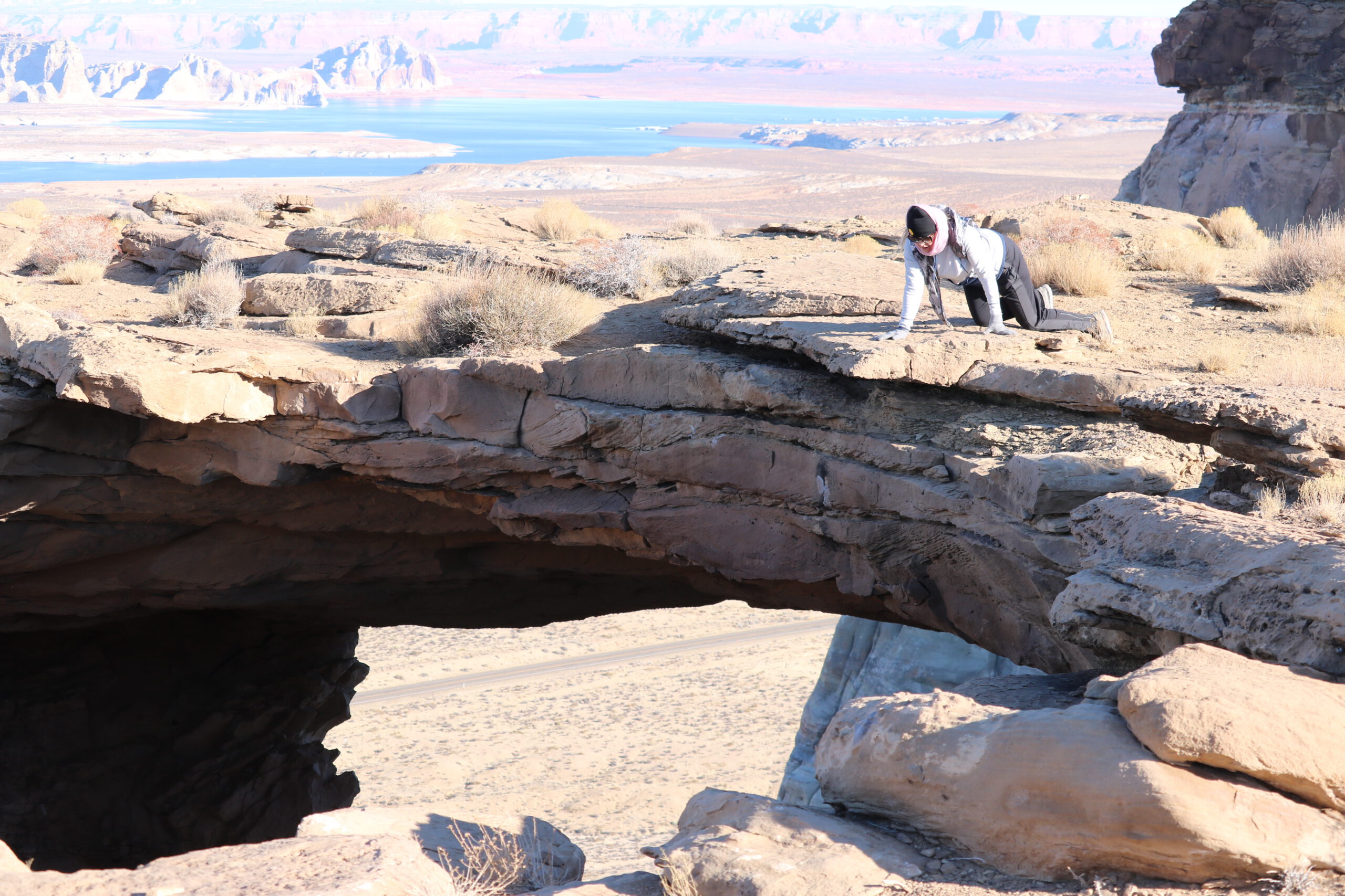
The Skylight Arch is a lesser known, horizontal arch. This rocky phenomenon is visible from Highway 89 in Southern Utah, at the Arizona/Utah border.
The hiking trail is free to the public, if you can find it. If you have cell-phone reception, you can use Google Maps to drive from Highway 89 to the backroads of Southern Utah, nearby Lone Rock Beach.
You’ll be driving off road, therefore an SUV, truck, or jeep is recommended. We took my Prius on a dry and sunlit day, however, the last mile of road is very rocky and isn’t good for low-riding vehicles. So we parked, and hiked one extra mile to the location (a total of 2 miles hiking each way).
The backroads have a lot of intersections, and rocky terrain at the end of the road. The good news is that you can get (Verizon) cell phone reception on this hike! So you can map it on your phone and it will guide you to the small parking area behind the mountain. On the way, you will find roadsigns for Vermillion Cliffs, at which you should go to the left, then veer slight right to go around the back of the mountain. You will be driving under several power lines, for about a mile.
If you get to the end of the road, you’ll have just a 1 mile hike, each way. The arch is almost difficult to notice from above ground, until you approach it, so be careful not to fall in. It’s a long way down.
[envira-gallery id=”986″]
There are spectacular views of Lake Powell, Lone Rock, Navajo Mountain, as well as other buttes and mountains in the distance. Spoiler alert! We put a few photos on this blog post!
You should bring water, good shoes/boots, a hiking buddy, and maybe a snack and a backpack. Use the restroom before coming, or bring a roll of TP to be safe. Dogs are allowed.