Liberty Vacation Rentals

Tag: page

  • Here’s Looking at You, 2022

    Here’s Looking at You, 2022

    Hey everyone, as we all recover from the pains and frustrations of the last two years, let’s invite each other to take a deep breath, and be still. Know that your journey here happened for a reason. You are meant to have a great vacation. We are honored that you considered us, and hope that our quality reputation continues.

    We have seen water levels drop around our illustrious Lake Powell, but there is a lot of lake remaining, and lots of fun to be had. You can still get boat rentals, jet ski and kayak rentals, as well as go for a swim at Lone Rock Beach or the “Chains” swimming area by the dam. The lower level allows for more fun with ATV rentals (also called “quads” or “razors”). You should try Epic Adventure Rides for an all-day ATV rental, if you don’t have a 4-wheel drive vehicle, or a Jeep.

    You will need a National Park pass (also called the “America The Beautiful” pass) for $80 annually, or a $30 weekly pass, to enter Lone Rock or the Wahweap Marinas. If you got the $30 pass, you have seven days to upgrade it for the yearly pass, which is a good value in my opinion!

    We have a new gazebo in the backyard of our property, and retaining wall, with views of the Grand Escalante mountain. Meet some other guests, and have an evening drink or your breakfast out back. The gazebo will light up at night, until about midnight. Our fruit trees will be blooming during summer, so pick an apple while you visit, if you feel so inclined (limit one per guest).

    I’m currently managing the property with occasional help from family. I have added exterior cameras for some extra security, however, we do have a very safe neighborhood. If I’m not available at the manager’s door, please text or call me. I might be out exploring canyons to add new footage to my YouTube channel.

    Thanks for visiting and supporting local business. I hope you love this area, and can stay at least for few nights.

  • Buckskin Gulch

    Buckskin Gulch

    What say you? In southern Utah or northern AZ and not sure what to do? You must not be looking deep enough — deep into the earth, that is.  Many tourists come into the area with a linear focus on Antelope Canyon, and they ignore other great places, such as Buckskin Gulch.

    Antelope is privately owned by a Navajo family, within the Navajo Nation, and beautiful, nonetheless.  As seen on Instagram, it is stunning. How could you not be in awe of such an incredible display of nature? What if I told you there’s another area close to Antelope Canyon that’s just as magnificent; even better, it’s Antelope Canyon on steroids? And… And… It’s much cheaper than Antelope.

    Don’t get me wrong:  Antelope is stunning and well worth the tour if you can afford it or make it with or without a reservation. Wouldn’t you rather or in addition to explore the longest slot canyon in the US, possibly the world? I have and will go back many more times to get my fix exploring this extremely amazing natural environment.

    Do you want the juice? Are you ready for the juice? LOL Here’s the juice… BUCKSKIN GULCH is the longest slot canyon in the United States and possibly the world. It’s around 40 miles west of Antelope Canyon. Yes, lovely adventure seekers!  Antelope Canyon is not the only slot canyon in the southwest. I bet you didn’t know there are well over 1,000 slot canyons below interstate 70 in Utah and quite a few more in northern Arizona. Unfortunately, most of the slot canyons require canyoneering skills, while some are not really worth the time and effort to explore.  And many are privately owned by the Navajo Nation.

    IN ADDITION TO…

    Buckskin Gulch is a slot canyon I have wanted to explore since 2017.  Here at Liberty Vacation Rentals, we host guests from around the world quite frequently. Once, we hosted twin sisters. They were super excited to hike this slot canyon and couldn’t wait to begin their journey. I was excited for them, until I read the details regarding this adventure. It so happens these ladies were going to hike the longest slot canyon in the US and most likely the longest one in the world. It’s located just under 30 miles from our AirBnB in southern Utah; 18 miles on the highway and then a few more, down road of gravel and dirt. The name BUCKSKIN GULCH comes from the color of deer hide. It’s also called Kaibab Canyon which makes more sense to me. Kaibab means “the mountain lying down.”  It’s a terrific alternative to Antelope Canyon or Waterhole Canyon, or Secret Canyon, or Cardiac Canyon, or Rattlesnake Canyon.  (Did you know there were so many?)  Sometimes, these other canyons have sold out of space, and have long waiting lines.  Think of Buckskin Gulch as another great hike, in addition to these slot canyon major attractions. It is a definite photo op for tourists and explorers, when they come to visit the area.

    IMG_2800

    GETTING THERE…

    From Highway 89, it’s less than ten miles down a road built for ranchers back in the day. Sometimes flash floods and weather will wash away portions of the road but the highway officials will fill it in with more gravel eventually. Any car will make the trek on a normal day if you take it slow and steady. Although during the winter months of snow or rain, only a four-wheel drive will make it down House Rock Valley Road to the parking area at the end.  Here, you can access The Wave (permit required), Wire Pass, and Buckskin Gulch. There are actually a few different parking areas. We found the one shared with The Wave is the best location to start the hike into Buckskin Gulch.

    At the parking area, grab a day use permit from the kiosk, deposit money, and fill in the form as instructed. Hike across the gravel road to start the trailhead for WirePass. Continue onto the Wire Pass trail. You will be heading back north close to the road. Protect yourself in the first mile because of the extreme sun exposure. It will curve to the right and head east. In the middle of WirePass trail you will come to a rock jammed in the narrow slot canyon. Just over the rock is a lower level. The rock adds at least two feet onto the level and you must pass over this rock to go further into the canyon. The second level is around six feet down. So it’s around eight feet you must climb down and back up when leaving. There is an alternative to WirePass to get to BUCKSKIN GULCH, but it’s worth the effort to move forward in this direction. This “rock jam” is the only obstacle for this pass. Be cautious using the rope provided around the rock. It’s not stable and you could fall off. Be careful.

    On with the trail. The next part of the hike will enter a confluence for WirePass and Buckskin Gulch. This is where you will hike north or south. We headed north and it was pretty spectacular. The gulch is much wider and the canyon walls vary in height. The extent of the canyon continues east for 40 some odd miles to Marble Canyon and Lee’s Ferry. There are several trails through the passes although I would suggest a day hike in and out of the canyon. Stay hydrated and aware of the weather, especially any flash flood warnings, during and after rainfall.  Take provisions. The only bathrooms are located at the trailhead. Don’t get caught up in sneaking into “The Wave”. It’s a hefty fine and possible jail time. Not worth the time and effort to see a landmark. Especially if you know where to look, you can see similar “waves” within other places all around the area.

    So… that’s the juice. Are you pumped to see Buckskin Gulch? I am definitely pumped to go back and to tell others. Antelope is amazing but you will be pleasantly surprised with this canyon. It’s cheaper and so much more to see. I would advise using AllTrails app to help you navigate this hike and so many others in the area. If you are staying with us in our AirBnB, we have so many places we can fill you in to explore more on your adventure and journey into nature and the WildWest.


    Antelope Canyon on Steroids – Side effects:
    Positive:  A spectacular performance of nature.
    Negative:  Watch for flash floods and heat exhaustion.


  • Antelope Canyon

    Antelope Canyon

    HISTORY of ANTELOPE CANYON –

    Imagine no social media, or even no internet.  You have a great natural wonder you want to share with others.  What do you do? How do you share this phenomenon with others? In 1992, at what we now know as Lower Antelope Canyon, Ken and his wife would sit on the side of the road waving down cars to tell them about this wonderful natural phenomenon on their private property. It was well over two decades until their efforts would prove beneficial.

    Today, Ken’s Tours hosts about 500 visitors a day. No more need to sit outside and wave down visitors. Due to a surge in travel, homestead lodging, and more social media sharing starting in 2012, a marvelous place such as Antelope Canyon has experienced a vastly large increase in explorers seeking a great adventure to share with others.

    [envira-gallery id=”1018″]

    MY EXPERIENCE –

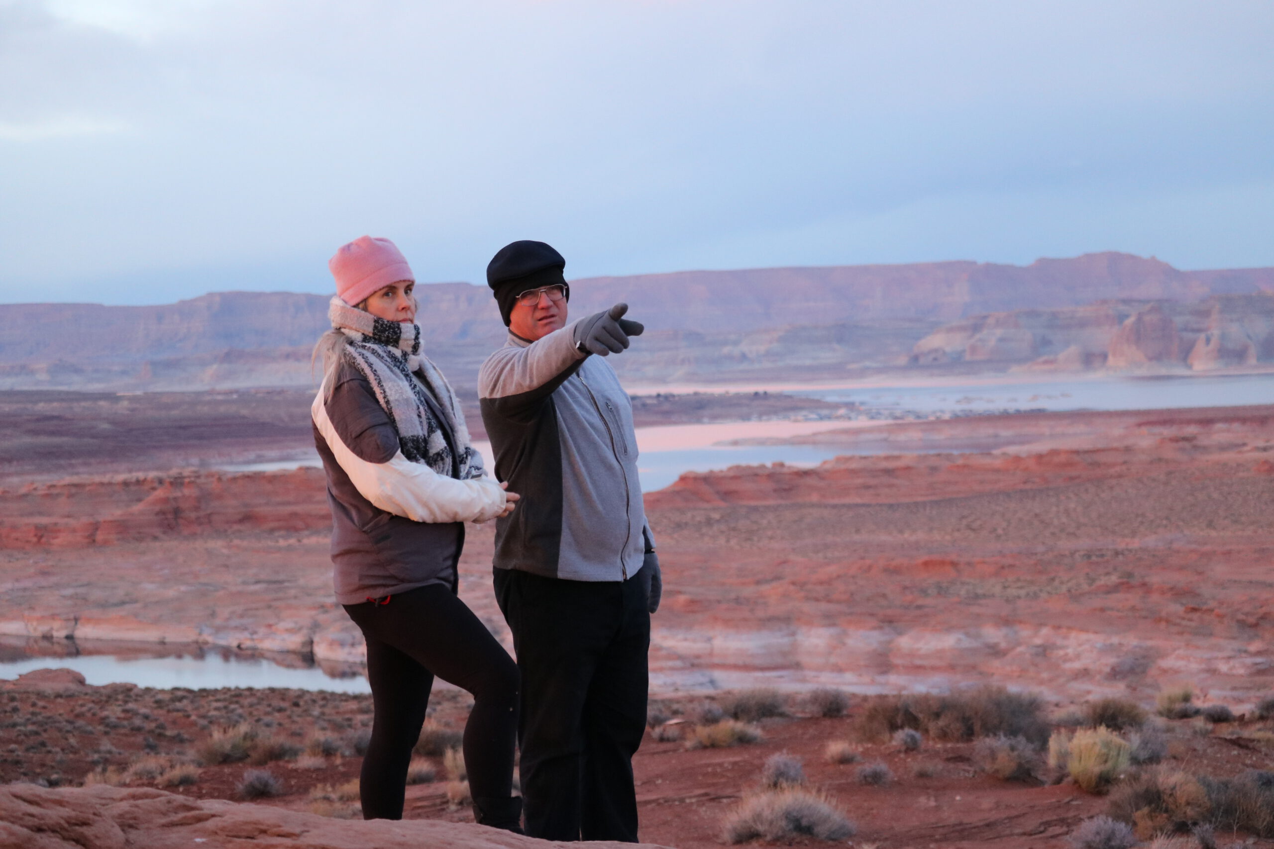
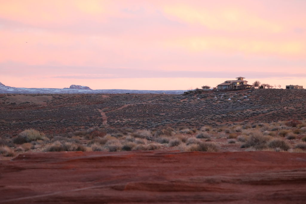
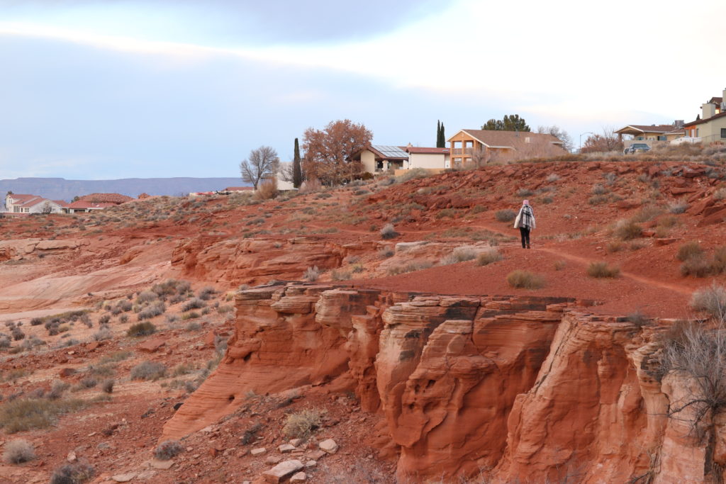
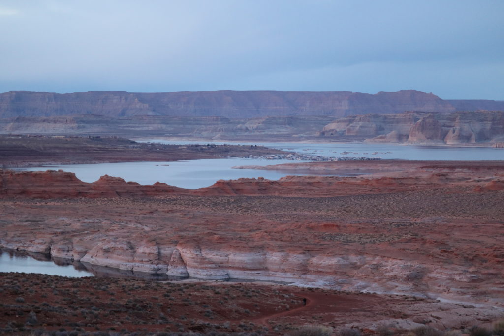
    Before moving to this area, I had no idea about Antelope Canyon, although I was well aware of The Grand Canyon. It’s about a two-hour drive to the north rim from our current location. Antelope Canyon is less than a thirty minute drive from Liberty Vacation Rentals. After arriving and searching the area on Google Maps, I saw the property was located really close to a massive body of water: Lake Powell. I grew up close to lakes and know that lake life is amazing.

    Our first year in Big Water, we cleaned up the building, and after much effort, opened it up to rent on AirBnB. Our first few guests mentioned Antelope Canyon but we still had no idea what it was and the extent of this natural phenomenon. Oh, the lovely resource of the internet! I went deep, exploring the area of northern Arizona and southern Utah. What a spectacular find of natural phenomenons: Grand Canyon, Zion, Bryce, Moab, Colorado River, and most of all… Antelope Canyon.
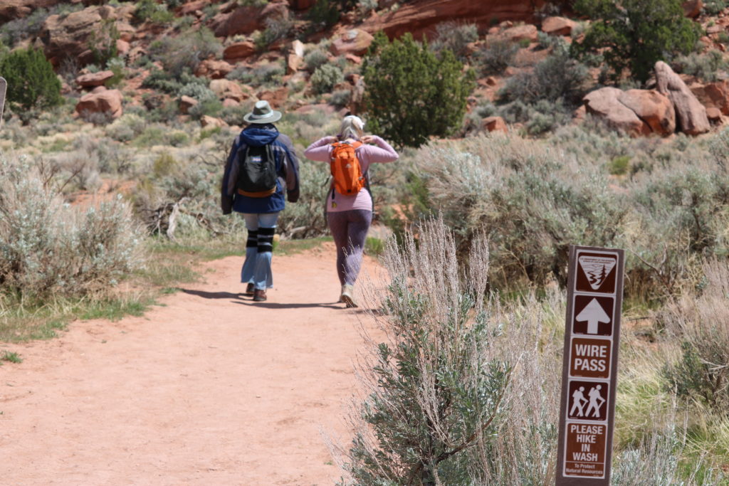
    GETTING A TOUR –

    Dixie Ellis and Ken’s Tours own the property rights to Antelope Canyon. A few years ago when we arrived, they were still getting used to the massive influx of visitors. A comfortable system to guide guests into the canyon had not been implemented. An allotment of twenty visitors per guide, every ten or fifteen minutes, was the standard. Complaints came in of the narrow canyon feeling “too crowded.” But what else can you do when hundreds of people are waiting two or more hours just to get in, all summer long?

    In March of 2020, we took a free-tour on a special day for locals, and learned that these tour companies will be reducing the crowds, tapering down the numbers to 10 people per guide.

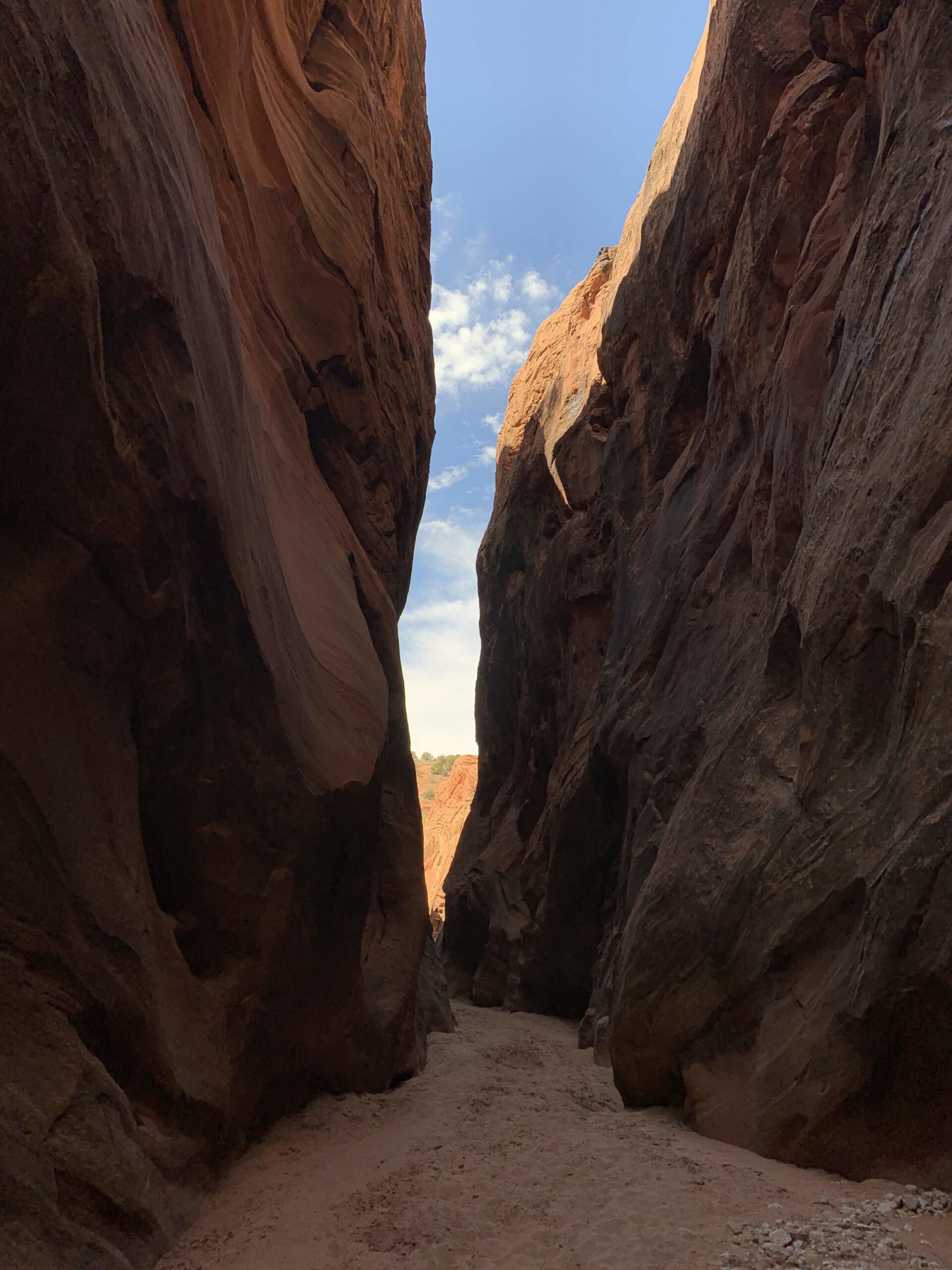
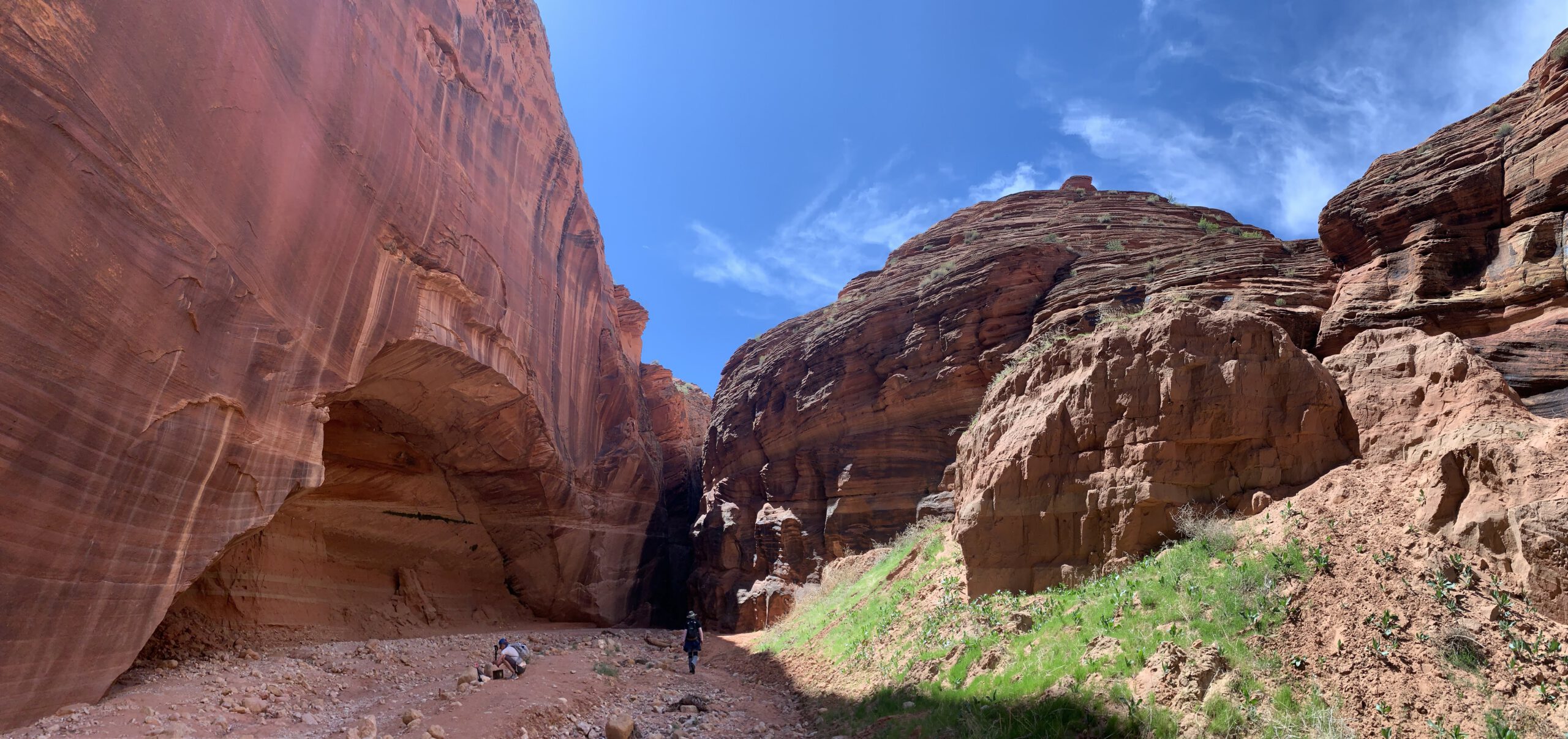
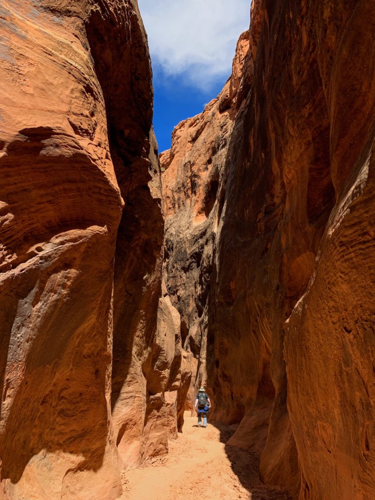
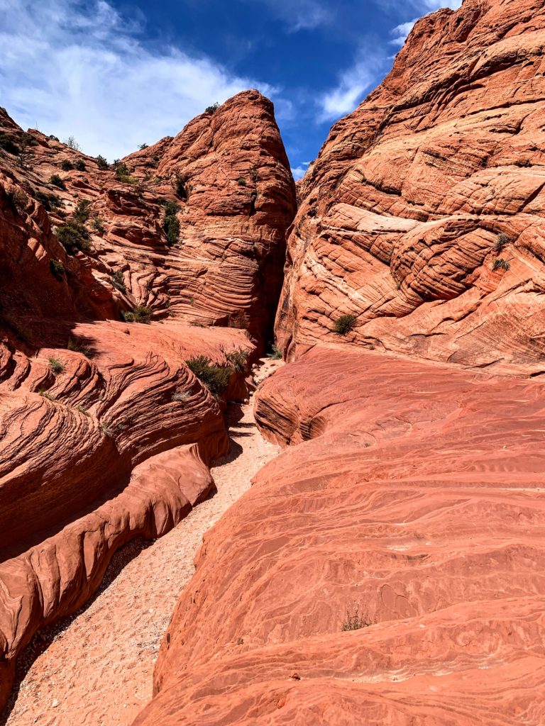
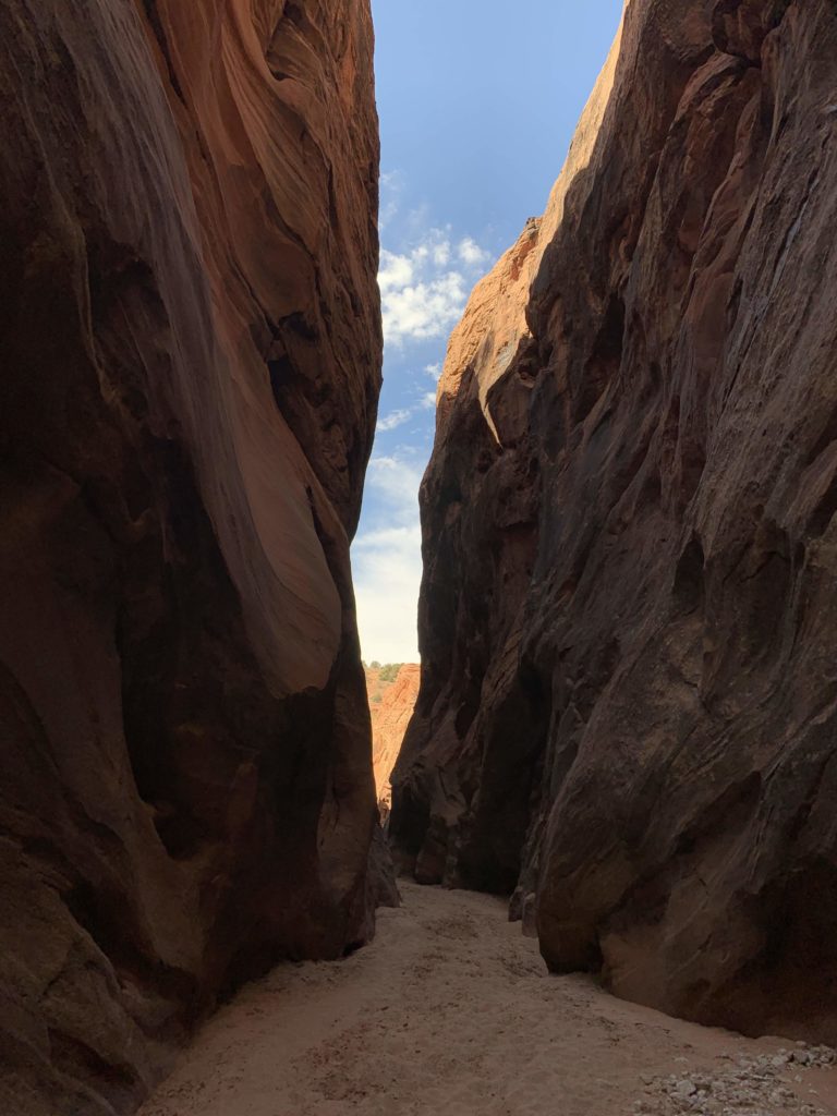
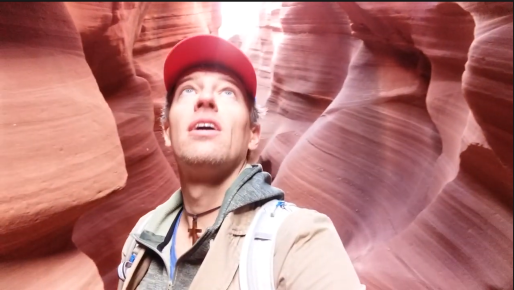
    We climbed down into the earth, via metal ladders installed for ease of access. Descending 55 feet with our guide, we begin our tour through the slot canyon. Several people packed into the sandstone channel began gasping and clicking away on cameras, while taking in such an incredible natural wonder.

    I remember the crowds in the canyon. I remember meeting several tourists. I remember standing in the 100 degree temperature. I watched videos of our journey. This time would be different. In 2020 we would tour Lower Antelope Canyon and I would remember all of it. Ken’s Tours and Dixie Ellis welcomed locals to tour the canyon two weekends in the “off season”. We didn’t realize until the end of the first tour locals had the opportunity to explore the canyon several times throughout the two weekends.

    Since we have lived in the area a few years, we consider ourselves locals. Living in an area mostly for vacationing, we, as locals, have incredible perks. (Read through our other blog posts for more local attractions.) Ken’s Tours and Dixie Ellis wanted to extend a gracious expedition to their exquisite unique sandstone rock formation.

    The first tour was Leap Day, 2020. The weather was a little cool with frequent sun rays and a few clouds. It wasn’t too hot and it wasn’t too cold. Since we are sort of deep in the canyon, I could have used a second long sleeves layer under my vest. Somehow the cool stays in the channel and remains a few degrees cooler throughout the year, up to ten degrees fahrenheit cooler. I knew this time my adventure through the canyon would be well documented and would definitely pay off if I keened in my super awareness of this grand experience. I was excited and grateful for Ken’s Tours gracious gift and I was assuredly going to take advantage of this offer.

    As you have been able to see the details of the canyon through social media postings, blog articles, video contents, and advertisements Antelope Canyon is undeniably a bucket list for all that venture into this marvelous rock we call Earth. There’s nothing new I can tell you about the canyon. It is one to be experienced, not just talked about or seen through the eyes of another. The take away from this post is to let you know how much the tour companies have advanced in their organization by developing a system more suitable for the enjoyment in the experience of the canyon. Navajo Nation Parks Administration toured the canyon and decided the groups touring were too large and could possibly cause damage to the natural sandstone wall.  It was decided to send in groups of ten visitors rotating companies Ken’s and Dixie every fifteen minutes. What an incredible change.

    As we descended into the canyon, we took many photos. I have an iPhoneX so I just assumed it would auto adjust to the lighting. Once we were half way through the tour the guide mentioned I should be using the “VIVID” setting. I had no idea where the adjustments to lighting were on the phone. As we moved forward, I played with the adjustments finding “COOL VIVID” worked just as well. The one camera setting I had not even thought to use was a vertical PANORAMIC. This setting takes in the extent of how tall the walls are in Lower Antelope Canyon. We even used a normal horizontal panoramic walking behind the shooter to position ourselves in the frame a few different spots. Oh boy… Technology is amazing.

    TWICE IN ONE WEEKEND –

    The next day we took advantage once again of the free tour for locals, and went through Lower Antelope a second time. This time we knew what to expect, how to use our time wisely and to ask the guide for more information. The second guide had so much information it was almost a bit overwhelming. We could occasionally hear the tour guide behind us speak of other areas in the canyon we had not paid much attention to. (Ask about the crystals in the walls.)

    I am amazed how much time I could spend in this canyon. It’s well worth the money to explore. Even more if you get to visit this canyon a few times. As I have already mentioned, Ken’s Tours has a building where visitors can wait comfortably for their tour to be called to go into the canyon.

    I asked about early check ins. YES! It is welcomed. You may check in early the day of your reservation and return fifteen minutes before your tour time. Although if you miss your reservation time, it’s likely you will need to make a new reservation and possibly lose the money for the tour missed. I suggest arriving one hour prior to the reserved time, hang out, speak with other visitors, learn of their plans in the area.

    OFF SEASON TOURS –

    Visiting “off season” makes a great difference in time spent exploring the canyon. I would venture to say October, November, February and March would be less crowded, although the tour companies are booked well in advance throughout the year. February seems to be the most logical time to visit without fighting through the crowds. And… Everything is cheaper.

    If you have the time and the money, I would suggest going through the canyons with a private tour guide or multiple visits. What an incredible way to see Earth and Mother Nature come together through technology for all of us to share our experience.

    Written by,
    JeniMae Baker

  • The Rim View Trail

    The Rim View Trail

    If you’re looking for some splendid panoramic views, and a moderately easy trail to hike for a few hours, the Page Rim View Trail is for you. This hike meanders around the city of Page AZ, as a 13 mile trail you can walk, run, or bike. Rent a bicycle from the Rim Trail Bike shop on North Navajo Drive, or simply enjoy a nice trek on foot.

    You’ll see great views of Lake Powell, the Glen Canyon Dam, the beginning of the Grand Canyon, Navajo Mountain, Tower Butte, and more. This trail crosses over many streets within the city of Page, so if you need to take a break or quit early to get food or a restroom, that’s not a problem.

    We hiked this on New Year’s Day, and although it was cold, it was very beautiful. We saw a few joggers fulfilling their resolution to start the year with some exercise. The trail is mostly very safe, with a few spots that require your attention. There is a small risk of falling 10 to 15 feet if you’re not watching out.

    Recommended to have sneakers, hiking boots, and water. Dress appropriately for the season. A walking stick is optional. Hiking late in the day? Take a flashlight.

    The trail will loop around the city of Page, including residential areas.

    The Rim View trail is moderately easy, with a few steep drop offs.

    hike the Rim View trail with a friend
    Take a friend and explore the Rim View trail, around Page!

    Lake Powell and Antelope Island

    a view of Tower Butte (on left), with Navajo Mountain (behind)

  • “Up, Up and Away!” Hot Air Balloon Regatta

    “Up, Up and Away!” Hot Air Balloon Regatta

    The 2018 Lake Powell Balloon Regatta gave rise to dozens of beautiful hot-air balloons, with enthusiasts rising high above the city of Page, Arizona, as well as the surrounding lake and canyons.

    Family fun activities included music, rides, and inflatables for kids of all ages.  Live music was also provided, throughout the day.  About 100 different vendors, with concessions and artisans’ crafts were for sale, and a part of the experience.  Admission to the event, and parking, is free.

    The Balloon Glow event continues in the evening, with a floating lantern ceremony as well. Dress warm for this outdoor event.

    [envira-gallery id=”668″]

    Photos by JennMarie Baker

  • Swimming by the Glen Canyon Dam

    Swimming by the Glen Canyon Dam

    A free and fun jaunt down to the lake’s “secret” swimming area is fun for any water baby. Turn toward the Hanging Gardens hiking trail, right by the bridge over the dam. This will be the second left after crossing the bridge, if you’re going south, and a quick right turn, before you reach the bridge, if going north. Of course, if you miss it, just turn around at the visitor center. The road will meander down for about a mile, to an unpaved parking lot with a public restroom. Some swimmers also follow a “tops optional” policy in this swimming area.

    [envira-gallery id=”550″]

    After you park, simply walk carefully down the slanted, sandstone canyon walls, until you reach the water. This is a great place to swim from late spring to late fall. If you’re a polar bear, the good news is that the water never freezes over, even in winter. This is because the heat of the sun insulates the canyon walls, transferring heat into the surface of the lake. Many swimmers will find the top three feet of the water much warmer than below.

    WARNINGS: This area of Lake Powell is beautiful, but adds a small amount of danger, as the water is over 400 feet deep, and no lifeguards are on duty. Be on the lookout for occasional debris or broken bottles, and if you have a heart, please pick up any trash that was left behind by less savvy visitors. A new threat is now in the lake as well: quagga mussels. These invasive clam-like growths, can be sharp and growing on the rocks. Just keep an eye out for them when entering and exiting the water. Braver souls may want to swim across the canyon and cliff dive. Watch out for rocks under the surface of the water when jumping in, and beware of jet skis and boats, if you are swimming far away from the beach area.

    CLICK HERE FOR VIDEO