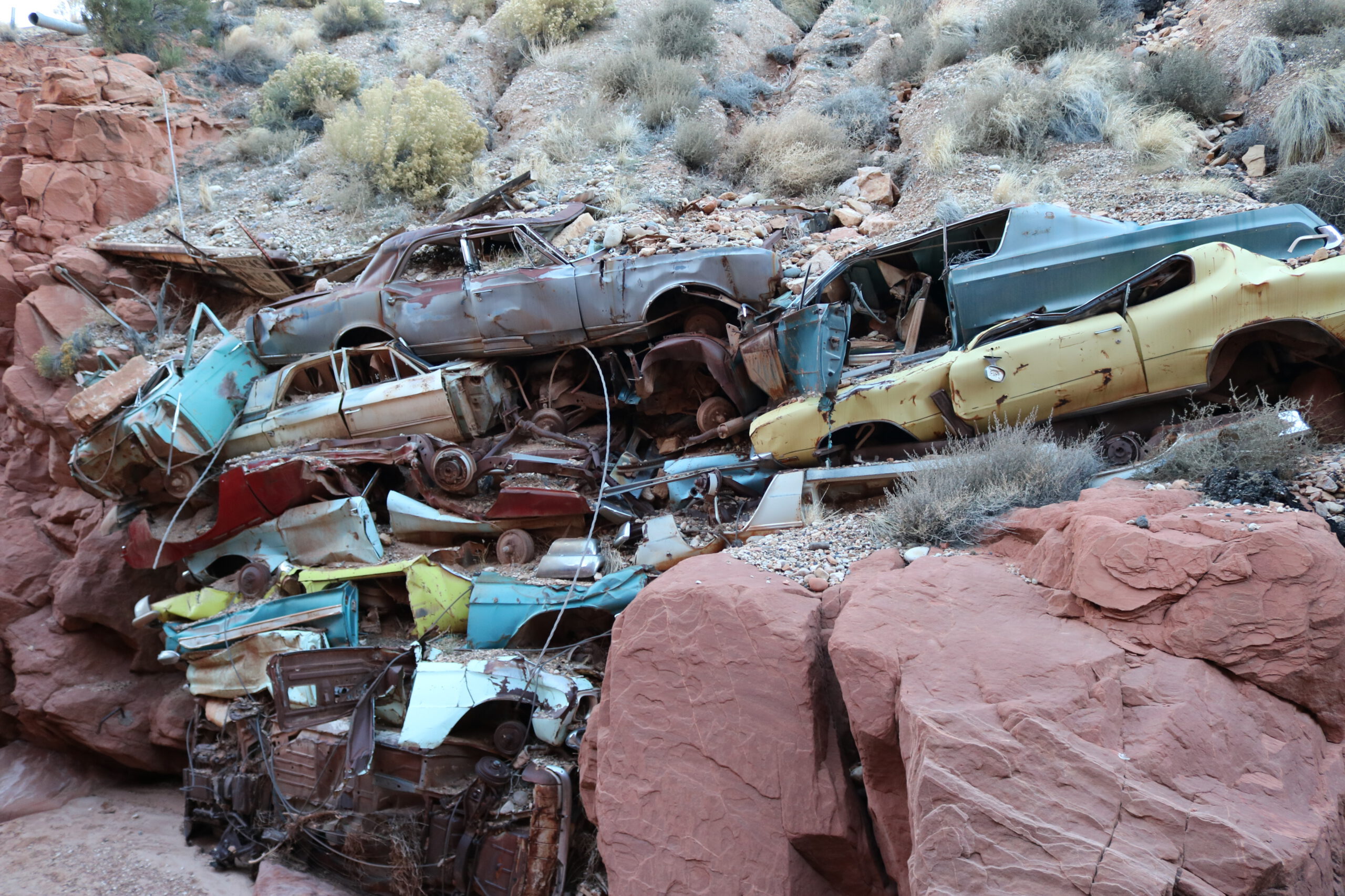
Rip Rap is located inside Catstair Canyon, not far from the Paria River. We had no idea this amazing relic existed until just recently. It’s a little known ruin of several classic cars, which were used decades ago to fill in a gap of the highway 89. You can find this in Catstair Canyon, just south of House Rock Valley Road. The hike is medium difficulty, but only about a half mile. Be careful around the abandoned vehicles, they may have sharp edges. It’s truly a sight to behold. On the other side of this canyon, you can find some petroglyphs. You won’t need an off-road vehicle to get here, but it will require some hiking in the canyon. There is no charge, or restrictions, to visit this site. There is no restroom or running water. (And please don’t litter.)
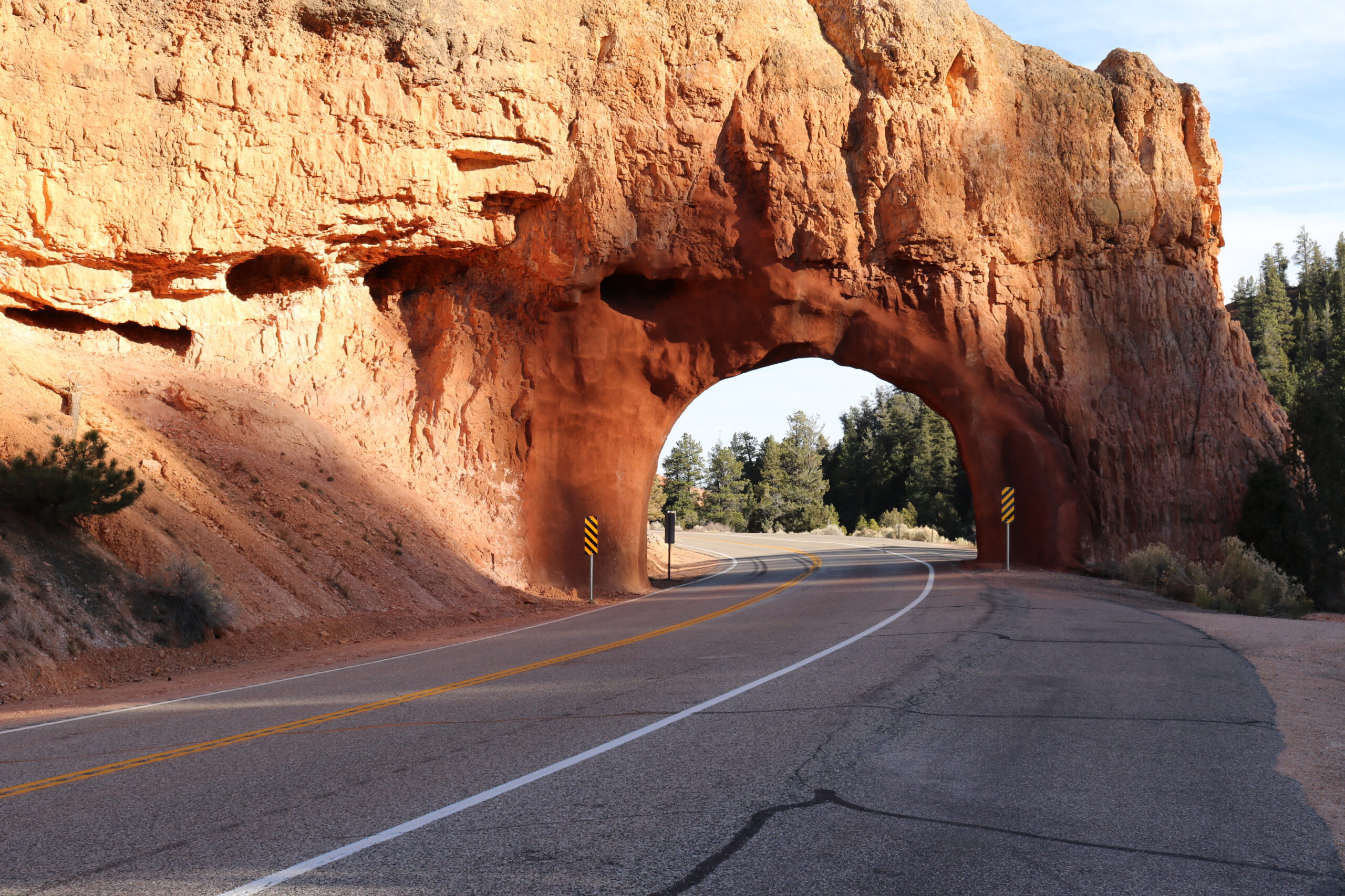
Bryce Canyon National Park is a sprawling reserve in southern Utah, known for crimson-colored hoodoos, in the shape of spire-shaped rock formations. The park’s main road leads past the expansive Bryce Amphitheater, a hoodoo-filled depression lying below the Rim Trail hiking path. It has overlooks at Sunrise Point, Sunset Point, Inspiration Point and Bryce Point. Prime viewing times are around sunup and sundown.
As this park is a two-hour drive west of Liberty Vacation Rentals, many travelers and tourists should consider making this a next destination after checking out with us. Many locations at Bryce Canyon park can be viewed in a day. We recommend driving to Rainbow Point for the most expansive view.
Inside the Bryce Canyon park is lodging and a restaurant, however, in the off-season, one may have to find quality restaurants just outside of the park in the Red Canyon area. Bicyclists can also enjoy a paved bike trail running through the The Red Canyon Bicycle Trail (a National Recreation Trail), running for more than 8 paved miles
REMEMBER: Practically all national parks, including Zion and Bryce Canyon, are not very pet-friendly; therefore, those planning to visit the parks should consider leaving their pets at home. Pets are prohibited on hiking trails, in the back country, and in all park buildings, and must always be on a leash no more than 6 feet long. An exception: the Rim Trail is a scenic, panoramic path where pets are definitely allowed, as long as they are on a leash at all times.
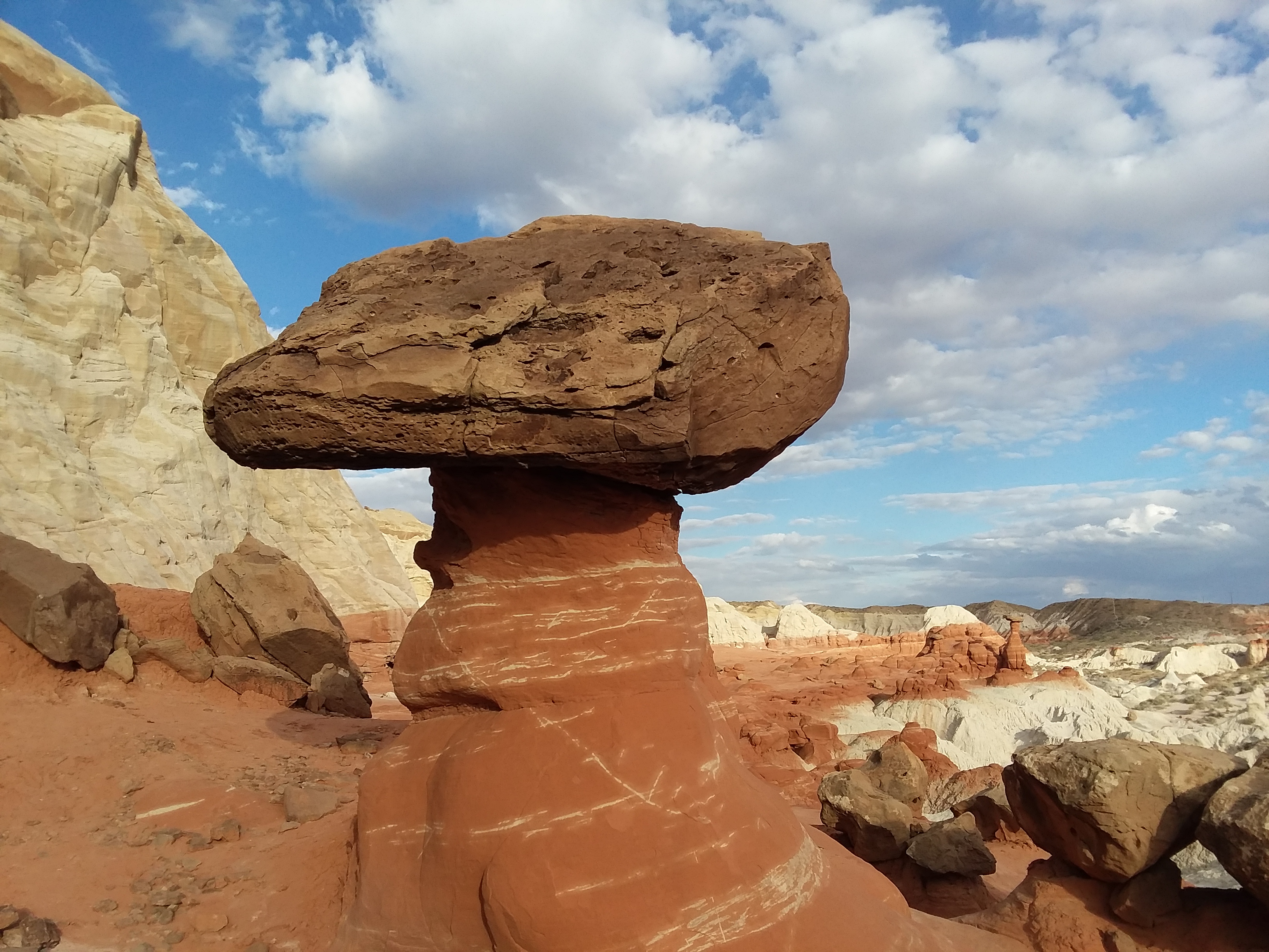
They have formed over thousands of years, and transform boring deserts into fantastical alien landscapes. “Hoodoos” are also called fairy chimneys, earth pyramids and tent rocks, and they exist as tall spires of rock that protrude from the bottom of arid basins and broken lands. They range from five-feet tall to the height of a 10-story building, and typically form from two weathering processes that continuously work together in eroding the edges of a rock formation. Hoodoos come in all shapes and sizes.
A large hoodoo, balancing by itself, for god-knows how long….
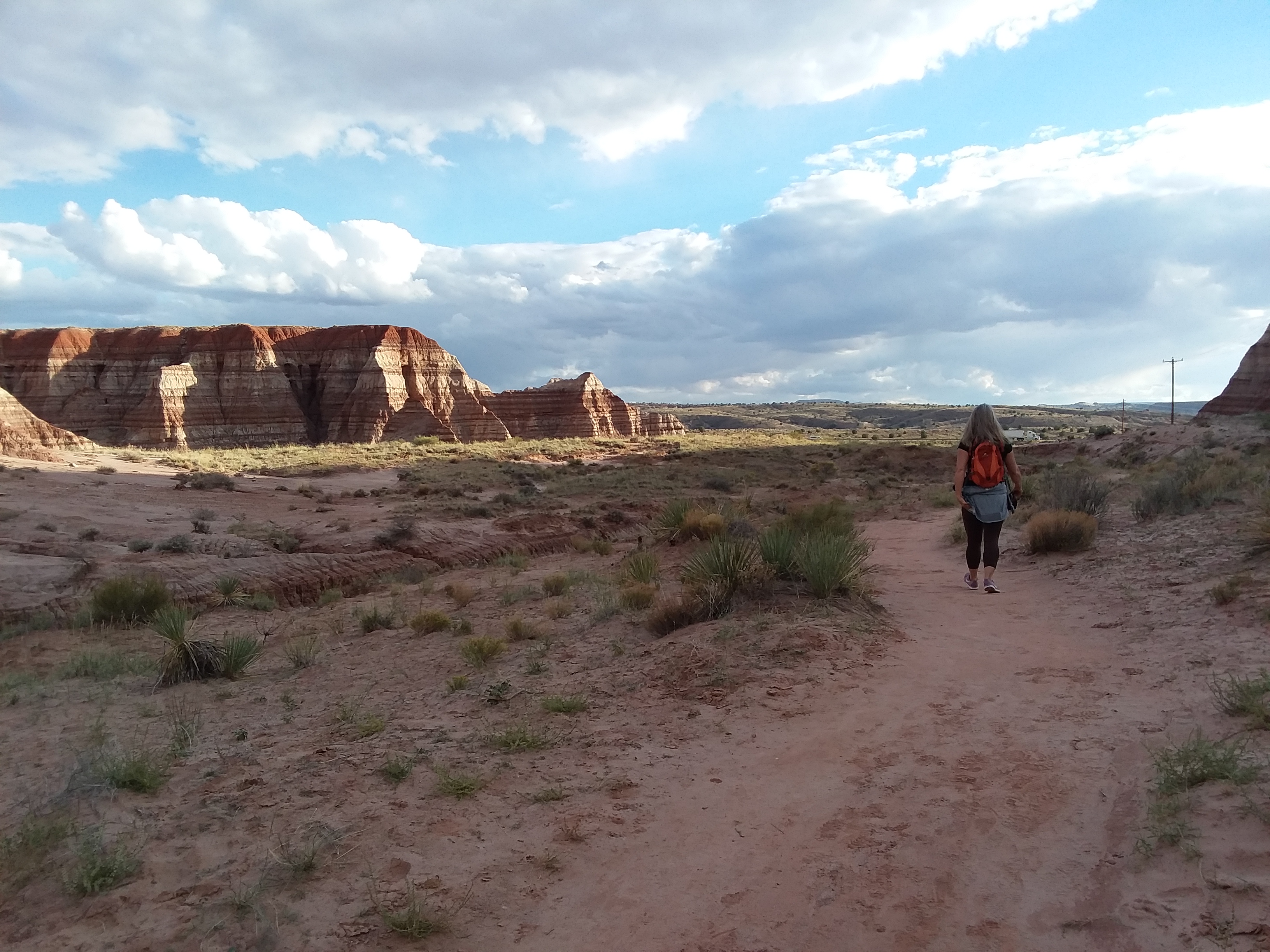
Just 10 miles south of our establishment, is an area full of hoodoos, known as the Toadstools. It’s a very easy, 1 mile hike, and good during any season of the year (avoid going on rainy days). The soft, crimson clay earth under your feet feels like walking on Mars. Who knows how long these rock formations will remain standing? Remember to respect nature and keep the area magically unspoiled: never try to push over or knock down a hoodoo, do not carve names into the rocks, and of course, take any trash with you.
JeniMae walking on the Toadstool Hoodoos trail, outside of Big Water, Utah.
If you’re more adventurous, you can hike a full four miles to see even more hoodoos. The trail is well defined, as dozens of people make this hike on any given day. Park your car in the lot near the trailhead sign. You can find it on Google Maps by searching for “Toadstool Hoodoos”. This hiking trail currently has no water fountain or public restroom.
If you need a great place to get rest after your journey, come and stay at Liberty Vacation Rentals! We’re just 10 miles east of the Toadstool Hoodoos.
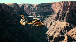
If you think helicopter tours are expensive, think again. We took a ride with Sundance Helicopter Tours, from the Page Arizona airport, and got an amazing view of Horseshoe Bend, Lake Powell, and the Glen Canyon Dam. Our pilot, Nathan, was very professional. The seats were comfortable, and the quality of the experience was unsurpassed. The pilot gave us commentary on some of the landmarks, and thanks to the design of the windows, we could see above, below, and practically all around us. We got some cool footage as well, on our new hand-held gimbal.
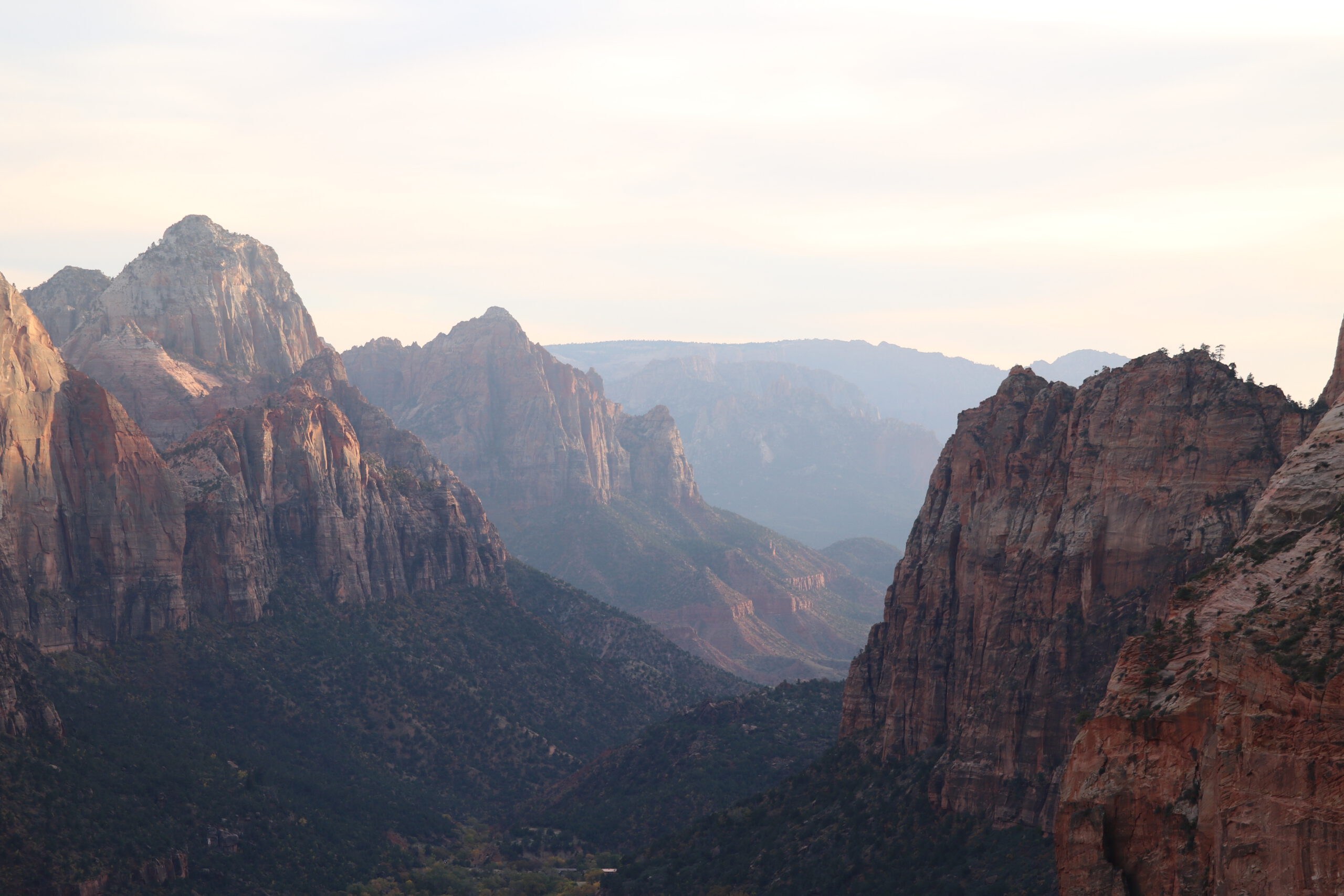
One of our absolutely favorite canyons to visit is the magnificent Zion. Its massive and naturally air-conditioned environment with unique terrain is unlike any other. Various forms of wildlife exist inside, including turkeys, deer, moose, chipmunks, mountain goats, and many birds. Occasionally, you may look on the canyon walls, and see professional mountain climbers scaling up and down.
This canyon is unlike many others in the area, as it features a lodge with hotel rooms, usually upwards of $200 per night, for two people. Because we’re just over a one-hour drive away, JennMarie and I like to go for day trips at Zion on a regular basis, and many of our guests do, as well.
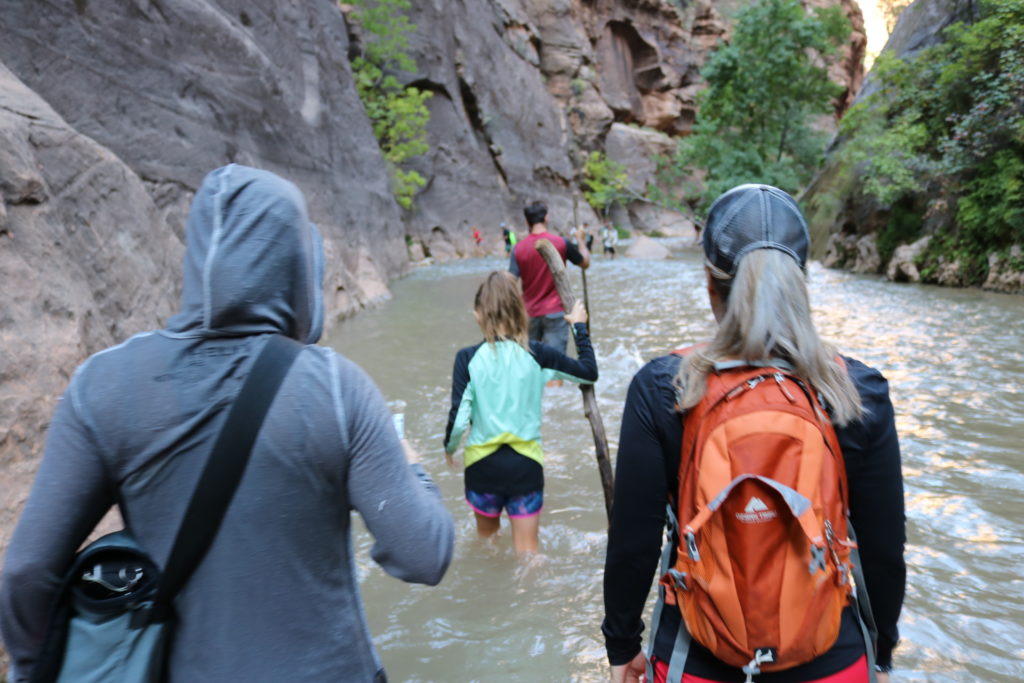
The Narrows hiking trail is actually a wet and wild experience. You’ll be trekking through the Virgin River, as it flows through Zion. Highly recommended, for healthy and agile explorers.
When visiting, you may park at nearly any shoulder off the main road, which zig-zags through the canyon, or you might also park at the visitor’s center. Hop aboard the free shuttle to travel to many of the hiking trails. Popular trails include: Angel’s Landing, Emerald Pools, the Narrows, Observation Point, and Weeping Rock. Check out these great photos, here on our blog, as well as the video link of Weeping Rock, below. The sun light coming through the clouds, as drip water seeped in front of us like a veener, led to some beautiful video.
In early September 2018, Utah experienced a couple days of massive, monsoon rain, which caused flash flooding and rock falls in Zion National Park in southwestern Utah. Such rainfall is rare, but will render some trails unsafe. The park received nearly 3 inches of rain in three hours on a Wednesday night. Now, many of the hiking trails have re-opened.
[envira-gallery id=”689″]
REMEMBER: Hike on days when flash flood warnings are not in effect, to keep your risk to a minimum. Keep your balance when going up in elevation. Pack snacks and water. Get food, drinks, and beer at the cafeteria in the lodge. Take your trash with you as you hike in the trails, and don’t feed wildlife.
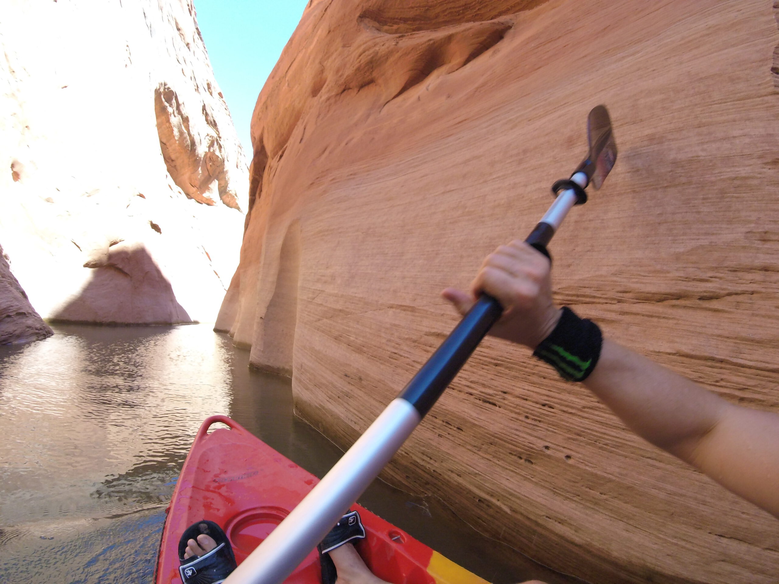
On busier days, multitudes of people come to visit Antelope Canyon, and whomever has promoted the walking tours has done an excellent job, as sometimes there are tourists turned away for lack of space. Perhaps, waiting for an hour or two for an opening, and then being squeezed in with a crowd of 25 people isn’t your idea of a great time? And perhaps you have the energy and endurance needed to get a good 2 to 3 hour paddle on a kayak? If so, do we have an idea for you…
[envira-gallery id=”541″]
Use your national parks pass to enter into Antelope Marina, just north of the walking tours on road #222, east of Page, Arizona. After you park in the lot, go down the ramp to the docks (and be early). You should be able to find single, double, and perhaps triple kayak rentals. You are able to rent them for a half- or full-day and then go west and south (left on the map, as a bird’s eye view) and then you’re entering the water-filled part of Antelope Canyon.
After paddling for about an hour, you should be able to park your kayak to the dried area of the canyon (perhaps some mud, at first) and then walk into it for much longer than a walking tour would allow. This area of the canyon is more remote and doesn’t have restroom or drinking water, so pack snacks and stay hydrated. If renting a kayak, be sure to give yourself up to 2 hours to return to the docks.
Rates are subject to change, but ask us for a brochure when you check in at Liberty Vacation Rentals. We still recommend this travel tip to all our guests, and they all tell us that it’s even better than just doing the walking tour.